CPP41721 Certificate IV in Surveying and Spatial Information Services (Surveying)
Gain practical and analytical skills to support a surveying team
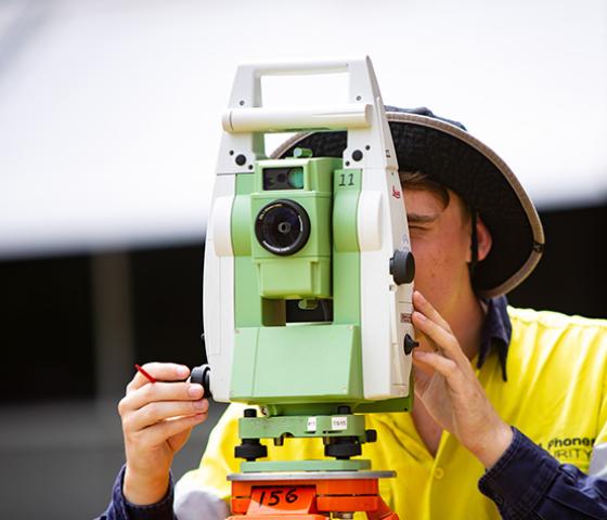
Develop your existing survey skills and learn to operate survey equipment and software working through advanced computations; GIS GPS equipment use and data storage; and create survey plans using survey software.
This qualification is directly aligned with priority industry areas where jobs are today, and into the future. As part of the state government Lower fees, local skills program, through to 31 December 2025 you'll only pay half the tuition fees (plus resource fee) capped at $1,200; or $400 if you're aged 15—24 or eligible for a concession.
^ You will pay half price for the tuition fees on the Lower fees, local skills qualifications, however other fees may apply such as Resource fees that are specific to your course. For full details see our Half price courses page.
CampusesEast Perth.
When Semester 1, 2024. Semester 2, 2024.
Study Mode On campus.
Looking to build on your surveying skills?
Equip yourself with the practical skills to support a surveying team by enrolling into the Certificate IV in Surveying and Spatial Information Services. This course is an ideal stepping-stone to further your training in the surveying and spatial information industry.
This qualification is delivered with a specialisation in surveying and on graduation you will receive a Certificate IV in Surveying and Spatial Information Services (Surveying).
During your studies, you will learn how to use surveying technologies and software to capture, process and present electronic data. You will also have access to surveying equipment in order to produce computer-aided drawings and survey plans so that you can prepare and present Geographic Information System (GIS) data.
Practical skills are combined, with important analytical skills like maintaining workplace safety and developing environmentally sustainable methods. Our lecturers are experts in the field with close ties to industry to ensure our training reflects the latest industry practices.
- Operate survey equipment and software
- Work through advanced computations
- Use GIS GPS equipment and data storage
- Create survey plans using survey software
I have the following attributes:
- Keen observation skills
- Comfortable working outdoors
- Able to work as part of team
- Methodical with an attention to detail
- Self-motivated with a positive attitude
- Effective communication skills
- Basic computer skills (e.g., proficient with Word, Excel, cloud storage software, etc.)
Follow the link to find further information to help you make an informed choice about the suitability of this course.
Important information
Select your preferred campus and apply
Semester 1, 2024
Details
Course fees
(Tuition fee* $1,200.00 + Resource fee $395.00 )
(Tuition fee* $400.00 + Resource fee $395.00 )
Half price fees
The Lower fees, local skills (half price) discount and fee caps have already been applied to the Tuition fees displayed above. Please note that fee caps only apply to the calendar year, so multi-semester courses across more than one calendar year may have a higher fee. See the Half price courses page for more details.
Lower fees, local skills are available to residents of Western Australia, and temporary residents holding certain visa types. They are not available for people living outside of Western Australia, or international students. Full eligibility details are available on our Half price courses page.
Enquiries regarding fees can be made by calling us.
T 1300 300 822
*Fee disclaimers
The fees quoted are estimates only and are for the entire course for students enrolling on a full-time basis. Please view the full list of Fee disclaimers.
Please note fees listed include all units required to gain this qualification. If you're a continuing student and have successfully completed a lower-level qualification that is a prerequisite for this course, you'll only pay for the units that you need to enrol in, to complete this course.
Enquiries regarding fees can be made by calling us.
Units
| National ID | Unit title |
|---|---|
| CPPSSI3020 | Perform simple surveying and spatial computations |
| CPPSSI4025 | Collect spatial data using GNSS |
| CPPSSI4036 | Operate spatial software applications |
| National ID | Unit title |
|---|---|
| AHCECR307 | Read and interpret maps |
| CPPSSI3011 | Produce basic maps |
| CPPSSI3019 | Produce basic plans of surveys |
| CPPSSI4022 | Store and retrieve spatial data |
| CPPSSI4030 | Operate surveying equipment |
| CPPSSI4031 | Perform surveying computations |
| CPPSSI4037 | Produce computer-aided drawings |
| CPPSSI4038 | Prepare and present GIS data |
| CPPSSI4039 | Design and produce maps |
| CPPSSI4040 | Collect spatial data using a total station |
| CPPSSI4041 | Set out site and building works |
| CPPSSI5060 | Develop spreadsheets for spatial data |
Semester 2, 2024
Details
Course fees
(Tuition fee* $1,200.00 + Resource fee $395.00 )
(Tuition fee* $400.00 + Resource fee $395.00 )
Half price fees
The Lower fees, local skills (half price) discount and fee caps have already been applied to the Tuition fees displayed above. Please note that fee caps only apply to the calendar year, so multi-semester courses across more than one calendar year may have a higher fee. See the Half price courses page for more details.
Lower fees, local skills are available to residents of Western Australia, and temporary residents holding certain visa types. They are not available for people living outside of Western Australia, or international students. Full eligibility details are available on our Half price courses page.
Enquiries regarding fees can be made by calling us.
T 1300 300 822
*Fee disclaimers
The fees quoted are estimates only and are for the entire course for students enrolling on a full-time basis. Please view the full list of Fee disclaimers.
Please note fees listed include all units required to gain this qualification. If you're a continuing student and have successfully completed a lower-level qualification that is a prerequisite for this course, you'll only pay for the units that you need to enrol in, to complete this course.
Enquiries regarding fees can be made by calling us.
Units
| National ID | Unit title |
|---|---|
| CPPSSI3020 | Perform simple surveying and spatial computations |
| CPPSSI4025 | Collect spatial data using GNSS |
| CPPSSI4036 | Operate spatial software applications |
| National ID | Unit title |
|---|---|
| AHCECR307 | Read and interpret maps |
| CPPSSI3011 | Produce basic maps |
| CPPSSI3019 | Produce basic plans of surveys |
| CPPSSI4022 | Store and retrieve spatial data |
| CPPSSI4030 | Operate surveying equipment |
| CPPSSI4031 | Perform surveying computations |
| CPPSSI4037 | Produce computer-aided drawings |
| CPPSSI4038 | Prepare and present GIS data |
| CPPSSI4039 | Design and produce maps |
| CPPSSI4040 | Collect spatial data using a total station |
| CPPSSI4041 | Set out site and building works |
| CPPSSI5060 | Develop spreadsheets for spatial data |
Get help
This form is only for course enquiries. If you would like to apply, please refer to the Study options and next steps section above.